Club Trails Download Data Warehouse
TRAILS DATA WAREHOUSE UNDERGOING RECONSTRUCTION
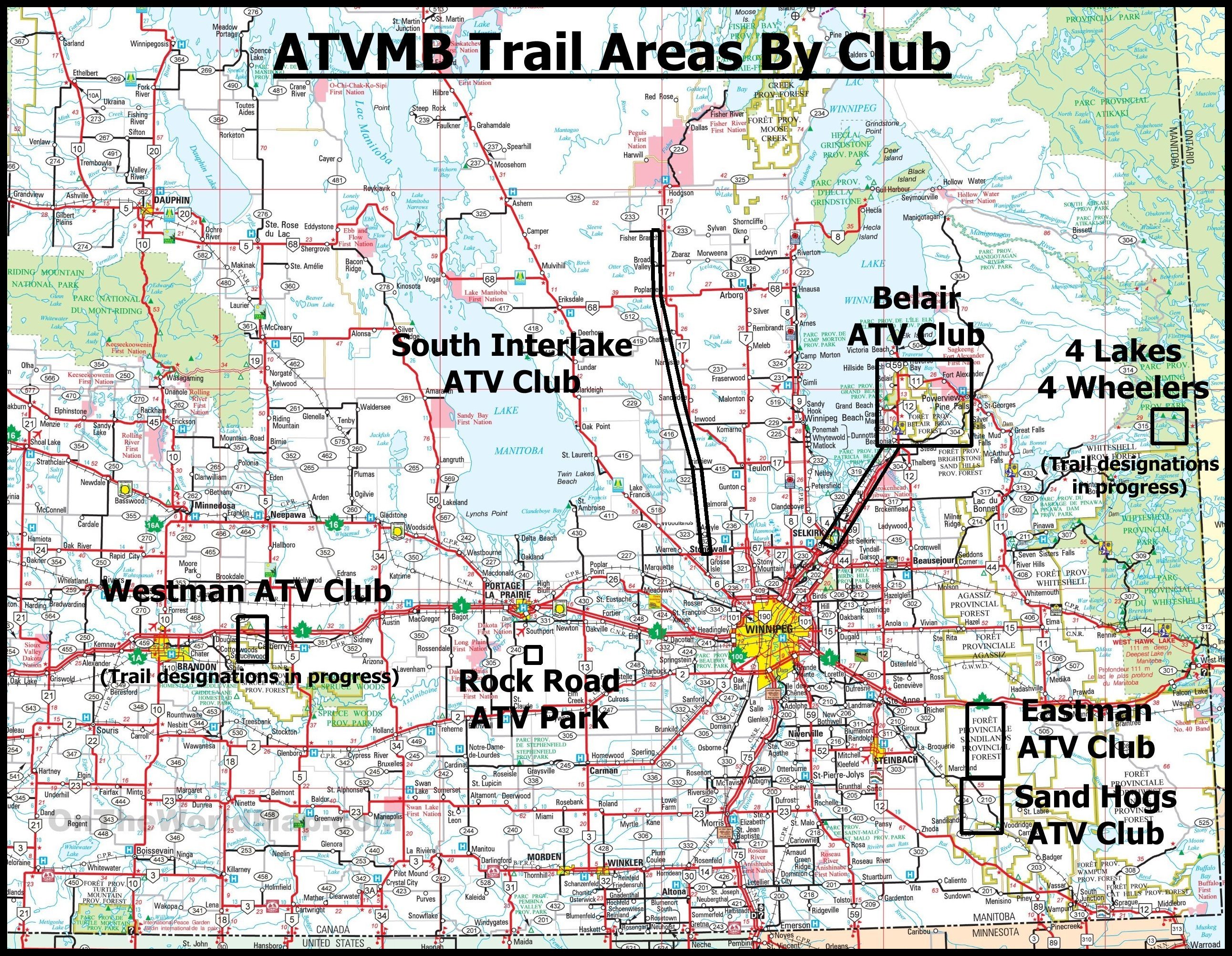
Trails download:
Digital download trails for various ATV Club regions are made available freely in several .GPX and .KML formats and detailed .JPG and/or .PDF maps are also provided to download and print if you wish.
Note:
Designated ATV trails are signed and managed by an ATV Club, In addition, there are hundreds of kilometers of other non-designated trails in the Belair Forest and Sandilands Forest that are not included in this trail mapping data. Non designated forest trails may or may not be passable due to overgrowth, dead fall trees and wet areas. These additional, non designated trails GPS data that surround the designated trails, can be acquired from other sources. It is up to the rider to exercise due diligence on any and all trails due to potential changing conditions and the fact that they are off road trails, the terrain and conditions can be quite varied. ATV riders are reminded that they ride these trails at their own risk and judgement. It is important to remember not to trespass onto private land without permission and to ride safe and be mindful and respectful of others.
Ownership of the data:
Note that data provided through these downloads are exclusively owned by the ATV Clubs and ATVMB and are made available freely to riders to help them navigate the trails. These data files are not to be repackaged in whole or in part nor value added to or copied and sold through any commercial offering. Please read the following full ownership and disclaimer user data agreement here: Read these Terms and Conditions of Data Use
Read these Garmin Install Instructions on how to install these GPS files.